

DSM versus DTM Data
Digital Surface Model (DSM)
A DSM is a topographic model of the earth's surface. The data comprises elevation measurements set out in a grid of equally spaced points and is derived from radar signals bounced off the first surface encountered. This includes buildings, vegetation, roads and other surface structures. DSM data is often used for simulated environments, improving topographic line maps and enhancing 3D fly-throughs for pilots.
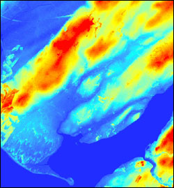
DSM intensity data.
Digital Terrain Model (DTM)
A DTM is a topographic model of the bare earth. The data also comprises elevation measurements set out in a grid, but is derived from the DSM data. It is a representation of the earth's surface with buildings, vegetation and other surface structures removed. This allows features to be seen that would otherwise be masked. DTM data is used for creating topographic maps, analysing terrain profiles and creating 3D models.
By looking closely at the two intensity images, it is possible to see the subtle differences in the data.
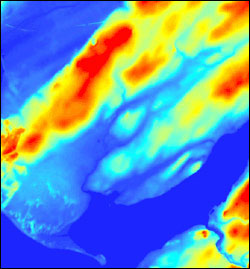
DTM intensity data.